


Hello and welcome back, my fellow AI enthusiasts and curious minds!
Have you ever had one of those moments where you learn about a technology that just blows your socks off? Well, buckle up because I’m about to take you on a wild ride through the world of Lidar. Trust me, by the end of this, you’ll be seeing the world in a whole new light (pun absolutely intended).
So What on Earth is Lidar, and Why Should You Give a Hoot?
Okay, let’s start with the basics. LiDAR stands for “Light Detection and Ranging.” It sounds like Star Trek, right? But here’s the cool part: it’s very real and changing our world in ways that would make even the most imaginative sci-fi authors like Isaac Asimov do a double-take.
In a nutshell, Lidar is like a supercharged radar that uses laser light instead of radio waves. It measures distances and creates incredibly detailed 3D maps of… well, pretty much anything. And when you throw AI into the mix? That’s when things get really interesting.
Now, let’s dive into some mind-bending ways this tech is shaking things up.
1. Self-Driving Cars: Your New Robot Chauffeur
It’s Monday morning, and your alarm goes off at 7 AM. You groggily stumble out of bed, grab your coffee, and head out the door. But instead of steeling yourself for a stressful commute, you hop into your car, mumble, “Take me to work,” and then sit back to enjoy your morning brew while catching up on your favourite true crime podcast. No, this isn’t a scene from “The Jetsons” or the aforementioned Isaac Asimov novel – it’s the rapidly approaching future of transportation, and Lidar is the magic wand making it all happen.
Now, let’s break down how this sci-fi scenario is becoming a reality. Companies like Waymo (Google’s ambitious self-driving car project) are using Lidar to give their vehicles a superhuman view of the world. Imagine having eyes in the back of your head, on the sides, and even on top—that’s what Lidar does for these cars. It creates a detailed 3D map of the vehicle’s surroundings in real-time, extending hundreds of meters in every direction.
But it’s not just about seeing everything – it’s about understanding what you see. That’s where AI comes in, acting as the brain to Lidar’s eyes. Here’s a mind-blowing fact: these self-driving cars can spot a jaywalking pedestrian, a kid chasing a ball, or a rogue cyclist from the length of a football field away. And not just spot them, but predict their movements too!
Let’s put this in perspective. You’re cruising down a busy city street in your Lidar-equipped self-driving car. Suddenly, a pedestrian steps off the curb between two parked vehicles, hidden from human view. Before you’ve even registered the movement, your vehicle has already calculated the pedestrian’s trajectory, determined if they’re on a collision course, and started to slow down smoothly or change lanes. All this happens in milliseconds – faster than you can say, “Whoa!” We’ve written extensively on LiDar and AI in autonomous vehicles, so if you’re looking to get started and extend your knowledge on AVs, be sure to check out one of our most popular AV articles entitled: Master Data Annotation for Autonomous Vehicles: A Comprehensive Guide.
The AI brains in these vehicles process all this Lidar data, making split-second decisions that would shame even the most skilled human drivers. It’s like having a Formula 1 driver, a champion chess player, and a supercomputer all rolled into one and stuffed under your car’s hood.
But it’s not just about safety (though that’s a huge plus). Think about productivity. The average American spends about an hour a day commuting. Now imagine getting that time back. You could finally finish that novel you’ve been working on, prep for your big presentation, or catch a few extra Z’s. The possibilities are endless!
Let’s not forget about accessibility. Self-driving cars could be a game-changer for elderly people, individuals with disabilities, or anyone who can’t drive, offering unprecedented independence and mobility.
So next time you’re stuck in mind-numbing traffic, gripping the steering wheel and muttering under your breath, imagine a future where your car does all the work while you relax. You could be reading a book, video chatting with friends, or even squeezing in a quick meditation session.
2. Urban Planning: SimCity, But The Real Deal
Remember playing SimCity as a kid? You know, that addictive game where you’d build your dream city only to accidentally unleash an alien invasion or a Godzilla attack? (Or is that just me showing my age?) Well, hold onto your hard hats because urban planners are basically doing that in real life now, thanks to Lidar. And the best part? No giant lizards are involved!
Let’s take a trip to Singapore, the poster child for high-tech urban planning. They’ve gone and created a complete 3D digital twin of the entire city-state. Yep, you heard that right – the whole shebang! It’s like having a miniature Singapore they can play around with, testing ideas before implementing them in the real world. Think of it as a sandbox mode for city planning but with real-world consequences.
Now, you might be wondering, “What’s the big deal? It’s just a fancy 3D model, right?” Oh, my friend, it’s so much more than that. This digital twin, powered by Lidar data and AI, is a living, breathing representation of the city. It doesn’t just show you what Singapore looks like – it can predict how it will behave.
Want to know the best spot for a new solar farm? Or figure out how to prevent flooding in low-lying areas? How about optimizing traffic flow during rush hour? Just plug the information into the model and let the AI crunch the numbers. It’s like having a crystal ball for city planning!
Let’s break this down with a real-world scenario. Say Japan is experiencing increased flooding in certain neighbourhoods due to climate change. In the past, urban planners might have had to rely on educated guesses or small-scale models to decide where to build new drainage systems. Now? They can simulate various solutions in their digital twin.
They might start by adding virtual drainage channels in different locations and then run AI-powered simulations of heavy rainfall events. The model would show them exactly how water would flow through the city, highlighting any areas that might still be at risk. They could tweak their plans, try different approaches, and find the optimal solution—all without moving a single shovel of dirt in the real world.
But it doesn’t stop at flood prevention. This Lidar-powered digital twin can help with all sorts of urban challenges:
- Energy Efficiency: By analyzing the 3D structure of buildings, planners can optimize solar panel placement or identify areas that need better insulation.
- Traffic Management: Simulate how new road layouts or public transport routes would affect traffic flow.
- Urban Green Spaces: Plan where to plant trees or create parks to maximize cooling effects and improve air quality.
- Emergency Response: Create detailed evacuation plans or optimize the placement of emergency services.
- 5G Network Planning: Determine the best locations for 5G towers to ensure maximum coverage.
The possibilities are practically endless! And the best part? As the real Tokyo changes, Lidar scans can update the digital twin, ensuring it always reflects the current reality.
Tokyo and Singapore aren’t the only cities getting in on this SimCity-style action. Barcelona, Helsinki, and Boston are just a few others creating their own digital twins. It’s like a high-stakes game of “Keeping Up with the Joneses,” but instead of fancy cars or new gadgets, cities are competing with cutting-edge urban planning tech.
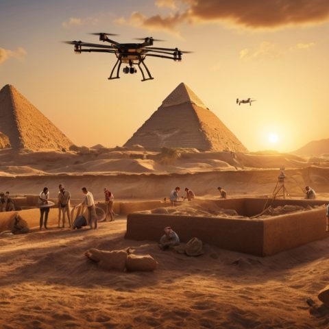
3. Archaeology: Indy, Eat Your Heart Out
Now, this is where things get super cool. Imagine being able to see through dense jungles to uncover lost cities, all without breaking a sweat or dodging any rolling boulders. That’s precisely what Lidar is doing for archaeology, and it’s turning the field on its head faster than you can say, “It belongs in a museum!”
Let’s talk about the archaeological equivalent of winning the lottery. In 2018, archaeologists used Lidar to discover over 60,000 hidden Mayan structures in Guatemala. Yes, you read that right – 60,000! That’s not just finding a needle in a haystack – it’s like finding an entire sewing kit, complete with a Singer sewing machine and a year’s supply of thread!
To put this in perspective, imagine you’re an archaeologist who’s spent years trekking through the dense Guatemalan jungle. You’ve battled mosquitoes, narrowly avoided stepping on venomous snakes, and possibly developed a severe case of jungle rot. After all that, you’ve uncovered maybe a dozen new structures. Then along comes Lidar, and in the time it takes to fly over the area, it reveals thousands of structures you couldn’t see from the ground. It’s like going from a magnifying glass to the Hubble Space Telescope overnight!
But how does it work? Lidar systems mounted on aircraft send out millions of laser pulses. These pulses penetrate the forest canopy and bounce back, creating a detailed 3D map of the ground below. Sophisticated AI algorithms then analyze this data, identifying tell-tale signs of human-made structures hidden beneath the vegetation.
The Guatemala discovery is just the tip of the iceberg (or should I say, the top of the pyramid?). Lidar is revolutionizing archaeology around the world:
- In Cambodia, Lidar revealed an entire medieval city hidden beneath the jungle near Angkor Wat.
- In England, it’s uncovering previously unknown Roman roads and settlements.
- In the American Southwest, it’s mapping ancient Native American pueblos in unprecedented detail.
- In Mexico, it’s revealing the true scale and complexity of ancient Mayan cities.
This technology is literally rewriting history books. We’re discovering that ancient civilizations were often larger, more complex, and more interconnected than ever imagined. It’s like finding out that your quiet, unassuming neighbour is actually a secret superhero!
But it’s not just about making significant discoveries. Lidar is changing how archaeologists work on a day-to-day basis. Instead of spending months or years surveying a site on foot, they can now get a detailed map in a matter of days. This allows them to plan excavations more efficiently, focusing their efforts on the most promising areas.
And here’s where AI comes into play again. By analyzing Lidar data from known archaeological sites, AI can learn to recognize patterns and predict where similar sites might be found. It’s like having a super-smart assistant who’s memorized every archaeology textbook ever written and can spot patterns that humans might miss.
Who knows what other secrets are hiding under the canopy of unexplored jungles? With Lidar and AI working together, we might be on the cusp of uncovering civilizations we never knew existed. We could be rewriting the entire timeline of human history!
So, the next time you watch an Indiana Jones movie, remember that while Indy’s whip-cracking adventures are fun, the real archaeological action today involves lasers, aircraft, and AI. It might not look as cool on the big screen, but it’s uncovering far more treasures than any fictional archaeologist could dream of. Indiana Jones would be green with envy!
4. Farming: Old MacDonald Had a Drone
Farming might be as old as civilization itself, but who says you can’t teach an old dog new tricks? Enter precision agriculture powered by our new best friend, Lidar. It’s like giving farmers superpowers, and trust me, it’s way cooler than a pitchfork!
Picture this: You’re a wine grower in Napa Valley. The sun’s just peeking over the hills, and you’re preparing for another day of tending to your precious grapes. But instead of lacing up your boots for a long trek through the vineyard, you pull out your tablet, fire up your drone, and settle back with a cup of coffee. Welcome to Farming 2.0!
Your Lidar-equipped drone takes off, buzzing over rows of vines like a high-tech honeybee. In just minutes, it’s scanned your entire vineyard, creating a 3D map so detailed it would make Google Earth blush. But this isn’t just any map. Oh no, this is like the Marauder’s Map from Harry Potter, but for agriculture!
With this magical map, you can see:
- Which plants are thirsty: Lidar can detect subtle changes in plant height and density, indicating water stress.
- Where pests might be partying: Unusual patterns in foliage could signal insect infestations.
- Areas where the soil needs some TLC: Variations in plant growth can indicate soil nutrient deficiencies.
- How your grapes develop: Lidar can even measure the size and density of grape clusters!
It’s like giving farmers an X-ray vision of their fields. You can spot problems before they become visible to the naked eye, potentially saving entire crops from disaster. And the best part? You haven’t even finished your morning coffee yet!
But wait, there’s more! (Sorry, I couldn’t resist the infomercial vibes there.) Lidar isn’t just for fancy wine growers. It’s revolutionizing agriculture across the board:
- In cornfields, Lidar-equipped tractors can adjust their sprayers in real-time, applying precisely the right amount of fertilizer to each plant. It’s like giving each corn stalk its own personal butler!
- Fruit growers use Lidar to measure the exact volume of their trees, helping them optimize pruning and harvesting strategies. It’s like having a fruity census!
- In livestock farming, Lidar helps monitor animal health and behaviour. It can even measure cattle’s body condition without disturbing them. Cow privacy matters, folks!
All this Lidar data is great, but it would take forever to analyze by hand. That’s where our silicon-brained friends come in. AI algorithms crunch through this data faster than you can say “automated tractor,” providing farmers with actionable insights.
For example, AI might notice that a particular section of your vineyard consistently underperforms year after year. It could then analyze soil data, weather patterns, and plant health metrics to suggest the perfect grape variety for that specific microclimate. It’s like having a viticulture expert, meteorologist, and soil scientist all rolled into one tireless assistant!
With AI analyzing all this data, farming is becoming less of an art and more of a science. But don’t worry, it’s not taking the heart out of agriculture. Instead, it’s freeing farmers to focus on what they do best – nurturing their crops and producing the best possible food (and wine!) for the rest of us.
And speaking of wine, let’s not forget the most important benefit of all this high-tech farming: better grapes mean better wine! So the next time you’re sipping a glass of Napa’s finest, raise a toast to Lidar and AI… the unsung heroes behind that perfect Cabernet!
But it’s not all about fancy wines and happy cows. This technology has the potential to revolutionize farming in developing countries, too. Imagine optimizing crop yields in areas threatened by climate change or quickly assessing damage after natural disasters. Lidar and AI could play a crucial role in ensuring global food security in the years to come. Want to go even more in-depth on LIDAR & AI in Agriculture? Check out our previous post on the Top 10 Computer Vision Applications in Agriculture & Farming in 2024.
5. Forest Management: Saving the Planet, One Tree at a Time
Our forests could use all the help they can get right now. With climate change, deforestation, and wildfires making headlines, it’s like our leafy friends are starring in their own disaster movie. But fear not! Lidar is stepping up to the plate in a big way, playing the role of the high-tech hero in this environmental blockbuster.
Imagine you’re a forest ranger in the vast Canadian wilderness. Your job? Keep an eye on millions of acres of boreal forest. No pressure, right? Thanks to Lidar, you’re not alone in this mammoth task. It’s like having a super-smart, tireless assistant who can see through trees and never needs a coffee break!
In Canada, they use Lidar to keep tabs on their enormous boreal forests. But this isn’t your grandpa’s forest survey. Oh no, this is like Google Earth on steroids, with a PhD in botany! Lidar-equipped aircraft fly over the forests, shooting out millions of laser pulses that bounce back, creating a 3D map so detailed you can practically count the needles on each pine tree.
This super-detailed, real-time map of the forest gives rangers and scientists an unprecedented view of the ecosystem. Here’s what they can do with this tree-mendous technology:
- Spot Disease Early: Lidar can detect subtle tree structure and density changes. If a section of forest is looking a bit under the weather, rangers can investigate before the problem spreads. It’s like having a doctor for trees!
- Predict Fire Risks: Lidar data can help identify areas at high risk for wildfires by analyzing the structure and density of the forest. This allows for more targeted prevention efforts. Smokey the Bear would be proud!
- Track Carbon Sequestration: Lidar can estimate the forest’s biomass, which directly relates to how much carbon it’s storing. It’s like having a real-time carbon calculator for the planet!
- Monitor Wildlife Habitats: The 3D forest maps can help identify ideal habitats for various species. It’s like running a matchmaking service for animals and their perfect homes.
- Plan Sustainable Logging: For areas where logging is permitted, Lidar data can help plan the most sustainable approaches, minimizing damage to the ecosystem.
But wait, there’s more! (I really need to stop watching late-night infomercials.) Lidar isn’t just for boreal forests. It’s being used in tropical rainforests, temperate woodlands, and even urban forests:
- In the Amazon, Lidar is helping track illegal deforestation by detecting changes in the canopy that might be invisible from satellite images.
- In California, it’s being used to identify drought-stressed trees that might be at risk of falling on power lines, potentially preventing wildfires.
- In New York City’s Central Park, Lidar has created a detailed inventory of every tree, helping with urban forest management.
Now, let’s talk about Lidar’s partner in crime-fighting (or, should I say, climate-change fighting): Artificial Intelligence. All this Lidar data is impressive, but it would take forever to analyze by hand. That’s where AI comes in, like the Robin to Lidar’s Batman.
AI algorithms can process this massive amount of data, identifying patterns and trends humans might miss. For example:
- AI can predict how a forest might change over time under different climate scenarios. It’s like having a crystal ball for trees!
- It can identify the early signs of invasive species spread, allowing for rapid response.
- AI can optimize reforestation efforts by suggesting the best species mix for a particular area based on Lidar data of successful forests.
With AI processing all this data, we’re improving at balancing conservation with sustainable use. It’s like having a guardian angel for our forests, one that’s really good at math and never sleeps!
But it’s not just about managing existing forests. This technology is also revolutionizing how we replant forests. There are even experiments with drone-based systems that use Lidar to map an area, identify the best spots for planting, and then literally shoot seed pods into the ground. It’s like Johnny Appleseed meets Terminator!
The potential impact of this technology is enormous. By better managing our forests, we can:
- Mitigate climate change by maximizing carbon sequestration
- Preserve biodiversity by protecting critical habitats
- Reduce the risk and impact of wildfires
- Ensure sustainable timber production for future generations
Mother Nature would definitely approve. And who knows? Maybe one day, thanks to Lidar and AI, we’ll be able actually to talk to trees. Now, that would be a conversation worth listening to! Until then, let’s raise a glass of sustainably harvested maple syrup to the unsung heroes of forest management.
6. Disaster Response: When Every Second Counts
When disaster strikes, chaos ensues. Hurricanes, earthquakes, floods, and wildfires can leave behind a trail of destruction and confusion. But Lidar technology is proving to be a lifesaver, cutting through the chaos and helping to save lives.
Remember Hurricane Harvey in 2017? It slammed into Texas, causing massive flooding and widespread damage. Emergency responders had a huge task ahead of them: figuring out which areas needed the most help. That’s where Lidar came in. By creating precise flood maps, responders could quickly see the hardest-hit areas and get help there.
But Lidar’s magic doesn’t stop at floods. Imagine being able to assess damage to buildings, predict landslides, or coordinate relief efforts—all from the safety of a command center. Lidar makes it possible. It’s like giving our emergency services superpowers, letting them see the full picture in real-time and act swiftly. When every second counts, this technology can be the difference between life and death.
Lidar helps emergency teams prioritize their efforts, ensuring aid reaches the most vulnerable people first. It also helps plan evacuation routes, getting people to safety as quickly as possible. And it’s not just about immediate response—Lidar data is invaluable for recovery and future planning. By studying the impacts of past disasters, we can better prepare for the future and build stronger, more resilient communities.
7. Renewable Energy: Making Green Energy Even Greener
We all know renewable energy is the future, but did you know that Lidar plays a significant role in speeding up that future? It’s true! Lidar technology is helping to supercharge our green energy efforts in ways you might not have imagined.
Think wind farms stretching across rolling hills or out in the open ocean. These majestic wind turbines convert wind into clean, renewable energy. But placing them in just the right spot is crucial for getting the most out of the wind. That’s where Lidar comes in, acting like a wind whisperer. Lidar can measure wind speeds at various heights with incredible precision, helping engineers pinpoint the perfect location for each turbine. This ensures that each turbine is positioned to capture the maximum amount of wind, boosting energy production.
For offshore wind farms, which can be even more challenging to set up, floating Lidar systems are a game-changer. Traditional methods for measuring wind speeds at sea can be incredibly costly and complicated, but floating Lidar systems provide the same accurate data at a fraction of the cost. These floating systems can be deployed in the ocean, collecting valuable wind data and making offshore wind energy projects more feasible and efficient.
But the magic doesn’t stop there. Enter artificial intelligence (AI). With AI analyzing all the data Lidar collected, we can optimize our renewable energy systems like never before. AI can process massive amounts of information quickly and accurately, identifying patterns and making real-time adjustments. This means we can squeeze every last efficiency drop out of our wind farms. Imagine turbines adjusting their angles or speeds based on real-time wind data to maximize energy output – that’s the power of combining Lidar with AI.
This high-tech approach isn’t just about making renewable energy more efficient; it’s also about making it more cost-effective. By optimizing turbine placement and operations, we reduce waste and increase the amount of clean energy generated. This leads to lower costs for producing green energy, which can translate to lower consumer energy prices. It’s a win-win situation – more green energy at a lower cost.
Lidar and AI are giving Mother Nature a high-tech helping hand, ensuring we’re harnessing renewable energy in the smartest way possible. As we strive for a greener future, these technologies are at the forefront, ensuring that we make the most of every gust of wind and every ray of sunshine. With innovations like these, the future of renewable energy looks brighter than ever.
8. Virtual Reality: Bringing the Real World into Virtual Spaces
Virtual Reality (VR) is undergoing a significant transformation with the integration of LiDAR technology, creating more immersive and realistic experiences by bringing real-world elements into virtual spaces.
LiDAR technology revolutionizes VR by enabling precise 3D mapping of physical environments. This allows for the creation of highly accurate digital replicas of real-world spaces, which can then be incorporated into virtual experiences. For example, users can scan their living rooms or outdoor spaces and recreate them in VR with remarkable fidelity.
The integration of LiDAR in consumer devices, such as Apple’s latest iPhones and iPads, has made this technology more accessible to the general public. Users can now create detailed 3D models of their surroundings using their smartphones or tablets, opening up new possibilities for VR applications.
One of the most exciting applications of LiDAR in VR is in gaming. Developers can now create games that blend virtual elements with the user’s real environment. For instance, a game could feature virtual characters interacting with the player’s actual furniture or hiding behind real-world objects[1].
Beyond gaming, LiDAR-enhanced VR has significant implications for various industries:
1. Architecture and Design: Architects and designers can create virtual walkthroughs of buildings before construction, with precise measurements and realistic lighting.
2. Education and Training: Students and professionals can engage in immersive learning experiences that accurately replicate real-world environments.
3. Real Estate: Potential buyers can take virtual tours of properties that are exact digital replicas of the actual spaces.
4. Entertainment: Film and TV production can use LiDAR-scanned environments to create more realistic visual effects and virtual sets.
The combination of LiDAR and artificial intelligence (AI) is pushing the boundaries even further. AI algorithms can analyze LiDAR data to generate realistic virtual environments based on real-world scans, enhancing the level of detail and realism in VR experiences.
As LiDAR technology continues to evolve and become more widespread, we can expect VR experiences to become increasingly indistinguishable from reality. This convergence of the physical and virtual worlds opens up new possibilities for how we interact with digital content and blurs the lines between what’s real and virtual.
9. Ocean Exploration: Finding Nemo (and Much More)
Believe it or not, Lidar works underwater too! Well, a special kind called bathymetric Lidar does. This advanced technology uses laser pulses to measure the depth of the ocean floor, providing highly accurate and detailed maps of underwater terrains.
The folks at NOAA (National Oceanic and Atmospheric Administration) use this cutting-edge technology to map America’s coastlines in incredible detail. It’s like giving our oceans an ultrasound, allowing scientists to see the underwater landscape with unprecedented clarity. This data is crucial for a wide range of applications, from ensuring safe navigation for ships to studying the impacts of climate change on our oceans. Accurate seafloor maps help predict sea-level rise and assess the health of marine ecosystems.
Moreover, with the integration of artificial intelligence (AI) analysis, the capabilities of bathymetric Lidar are greatly enhanced. AI can process vast amounts of data quickly and accurately, enabling scientists to track changes in coral reef health, monitor coastal erosion, and even identify the best routes for undersea internet cables that keep our global communications, including Netflix streaming, running smoothly. This level of detail and accuracy in mapping and monitoring our oceans can help conserve marine life and habitats, guiding efforts to protect vulnerable species and ecosystems.
Jacques Cousteau, the legendary ocean explorer and filmmaker, would be thrilled with these advancements. His pioneering spirit lives on as we continue to explore and understand the mysteries of the deep blue sea, using unimaginable technologies in his time. Through bathymetric Lidar and AI, we are not just finding Nemo but uncovering a wealth of knowledge that will help preserve our oceans for future generations.
10. Art and Cultural Preservation: Saving History in 3D
Last but certainly not least, Lidar is becoming a guardian angel for our cultural heritage. It’s like having a superhero dedicated to protecting our history, minus the cape and tights (though I’d pay good money to see a Lidar-themed superhero movie).
Remember the heartbreaking fire at Notre Dame Cathedral in Paris? The whole world watched in horror as flames engulfed this iconic structure. But here’s where our story takes a turn for the better, thanks to our laser-wielding friend, Lidar.
Just two years before the fire, an art historian named Andrew Tallon had meticulously scanned the entire cathedral using Lidar technology. Little did he know that his work would become invaluable in ways he couldn’t have imagined. Thanks to this detailed Lidar scan, restoration efforts now have a precise 3D blueprint from which to work. It’s like having a time machine for buildings!
But let’s break down what this means in practice:
- Precise Reconstruction: The Lidar scan captured details down to the millimetre. We’re talking about every gargoyle, intricate carving, and subtle curve of the architecture. It’s like having the original architectural plans but infinitely more detailed.
- Historical Accuracy: The scan shows not only what Notre Dame looked like before the fire but also centuries of subtle shifts and changes in the structure. This allows restorers to recreate not just the original design but the living history of the building.
- Structural Analysis: The Lidar data provides crucial information about the cathedral’s structural integrity, helping engineers ensure the restored building will be stable and safe.
- Virtual Preservation: While the physical restoration is ongoing, virtual reality experiences based on the Lidar data allow people to “visit” Notre Dame as it was before the fire. It’s like a digital time capsule!
But Notre Dame is just one example. Lidar is revolutionizing cultural heritage preservation around the world:
- In Egypt, Lidar is being used to map ancient tombs and tunnels, revealing hidden chambers and passages. It’s like giving archaeologists an X-ray vision!
- At Angkor Wat in Cambodia, Lidar has revealed the full extent of the ancient city, showing that it was far larger and more complex than previously thought.
- In Rome, Lidar scans of the Colosseum are helping conservators track subtle changes in the structure over time, allowing for more proactive preservation efforts.
Now, let’s talk about how AI is joining forces with Lidar to become the dynamic duo of heritage preservation:
- Predictive Maintenance: AI can analyze Lidar scans to spot tiny signs of wear and tear in historical sites, often before they’re visible to the human eye. It’s like having a super-attentive caretaker who never sleeps.
- Restoration Planning: By simulating different restoration approaches using Lidar data, AI can suggest the best ways to restore damaged structures while preserving their historical integrity. It’s like having a time-travelling master craftsman on your team.
- Virtual Tourism: AI can use Lidar data to create incredibly detailed virtual tours of historical sites. This not only makes these wonders accessible to people who can’t visit in person but also helps preserve fragile sites by reducing physical foot traffic. It’s like being able to touch history without actually touching it!
- Artifact Analysis: For smaller artifacts, micro-Lidar scans combined with AI analysis can reveal details about how objects were made, used, and even how they’ve changed over time. It’s like giving each artifact its own personal historian.
- Lost City Discovery: By analyzing Lidar data of large areas, AI can identify patterns that might indicate hidden archaeological sites. It’s like having a treasure map for lost civilizations!
The possibilities are mind-boggling. Imagine being able to:
- Take a virtual walk through ancient Rome at its peak, based on Lidar scans of ruins and AI reconstructions.
- Watch as AI shows you how a crumbling castle might have looked in its heyday, then guides you through the restoration process.
- Explore fragile cave paintings without risking damage to the original site.
It’s like giving our history an insurance policy, a time machine, and a really cool interactive museum exhibit all rolled into one!
But it’s not just about preserving the past. This technology is also changing how we create and document the present. Architects are using Lidar to create incredibly detailed models of new buildings, ensuring that future generations have accurate records of our current architectural achievements. It’s like writing a love letter to the future in laser light! Who knew that the key to preserving our past would come from technology straight out of science fiction?
Hey Doc, The Future’s So Bright, We Gotta Wear Shades (and Carry Lidar Sensors)
Whew! What a ride. From self-driving cars to uncovering lost cities, from saving lives in disasters to preserving our cultural heritage, Lidar and AI are working together to reshape our world in astonishing and unique ways.
And here’s the kicker: we’re just scratching the surface. As this tech gets cheaper and more accessible, who knows what awesome applications we’ll see next? Have questions or just want to chat? Feel free to reach out to us, as we’re always happy to chat with fellow LiDAR and AI enthusiasts! Perhaps you or your organization are looking to jump-start your next LiDAR project. If so, be sure to check out our 3D Point Cloud Annotation Services for LIDAR Technology.
So next time you see a self-driving car cruising down the street or hear about a new archaeological discovery, you can nudge your friend and say, “Hey, I know how that works!” And who knows? Maybe it’ll inspire you to join the Lidar revolution yourself.